We know how important our roads infrastructure is to you. Check out the frequently asked questions below to learn more about how roads are assessed, when road repairs are scheduled and which roads the Town and the Region of Peel are typically responsible for.
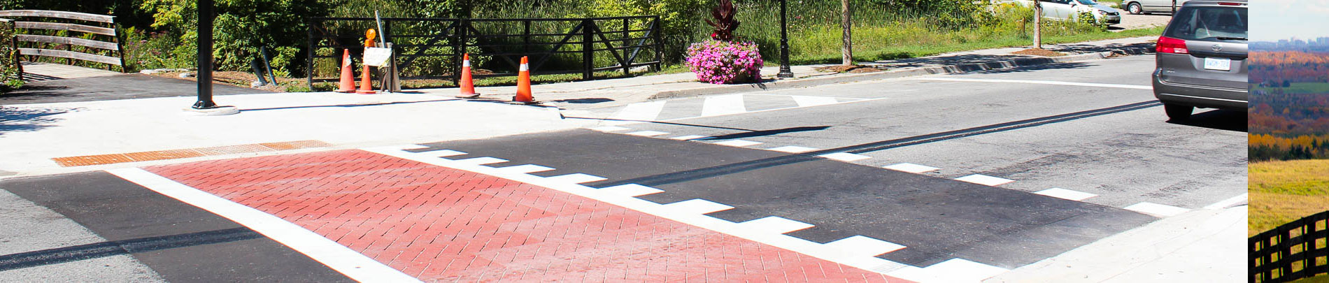
See where construction is happening in your community.
Current projects |
|
Future projects (five-year forecast) |
Our five-year road rehabilitation forecast for 2020 to 2024 includes
- asphalt removal and replacement,
- curb and gutter/sidewalk repair,
- grading works within the right of way to improve drainage, as well as
- design and construction of roads to accommodate growth.
Please note: bridge rehabilitation is not included in the list. The forecast is based on current data and budget allocations.
Road rehabilitation and reconstruction priorities are subject to change based on:
- Annual Council budget approval
- Unexpected deterioration observed in the biennial Town Road Assessment
- Emergencies
- Safety issues
- Drainage Issues
- Coordination with other agencies such as the Region of Peel, MTO, etc.
Definitions:
- ADT - Average Daily Traffic - The average number of vehicles two-way passing a specific point in a 24 hour period
- PCI - Pavement Condition Index - A numerical index between 0 and 100 which is used to indicate the general condition of a pavement
***Updated December 6, 2019
2020 |
2020 |
Item |
Road |
From |
To |
Length (Metres) |
ADT |
PCI |
Ward |
1 |
THE GRANGE SIDE RD |
McLaren Rd |
McLaughlin Rd |
650 |
366 |
4 |
1 |
2 |
THE GRANGE SIDE RD |
Heart Lake Rd |
Horseshoe Hill Rd |
1400 |
388 |
1 |
1 |
3 |
THE GRANGE SIDE RD |
Kennedy Rd |
Heart Lake Rd |
1400 |
400 |
4 |
1 |
4 |
OLD SCHOOL RD |
Heritage Rd |
Mississauga Rd |
1400 |
1577 |
14 |
2 |
5 |
OLD SCHOOL RD |
McLaughlin Rd |
Rail Line RR |
240 |
2599 |
9 |
2 |
6 |
OLD SCHOOL RD |
Rail Line RR |
Hurontario St |
1140 |
2599 |
12 |
2 |
7 |
OLD SCHOOL RD |
Heritage Rd |
Mississauga Rd |
1400 |
1577 |
14 |
2 |
8 |
HEART LAKE RD |
Beech Grove Side Rd |
1500m N of Beech Grove Side Rd |
1500 |
462 |
22 |
1 |
9 |
HEART LAKE RD |
Castlewood Crt |
650m S of Castlewood Crt |
650 |
462 |
27 |
1 |
10 |
HEART LAKE RD |
McGregor Dr |
Castlewood Crt |
200 |
462 |
18 |
1 |
11 |
HEART LAKE RD |
Highpoint Side Rd |
McGregor Dr |
1500 |
462 |
16 |
1 |
12 |
HEART LAKE RD |
Hwy 9 |
High Point Sdrd |
1800 |
486 |
22 |
1 |
13 |
CHINGUACOUSY RD |
Boston Mills Rd |
Old Pavillion Rd |
130 |
443 |
28 |
2 |
14 |
CHINGUACOUSY RD |
Old Pavillion Rd |
King St |
3000 |
443 |
18 |
2 |
15 |
MISSISSAUGA RD |
Queen St W |
500m South of Queen St W |
500 |
614 |
8 |
1 |
16 |
MISSISSAUGA RD |
Beech Grove Side Rd |
1050m N of Beech Grove Side Rd |
1050 |
614 |
8 |
1 |
17 |
MISSISSAUGA RD |
2.3km South of Charleston Sd Rd |
2.9km South of Charleston Sd Rd |
600 |
|
17 |
1 |
18 |
CREDITVIEW RD |
Boston Mills Road |
Kennedy Road |
770 |
|
18 |
2 |
19 |
PATTERSON SIDE RD |
Innis Lake Road |
Centerville Creek Road |
1340 |
|
15 |
4 |
20 |
CASTLEDERG SIDE RD |
Centerville Creek Road |
The Gore Road |
1400 |
|
27 |
4 |
21 |
PIERCY RD |
Holland Dr |
Polenta Cres |
170 |
541 |
17 |
5 |
22 |
PIERCY RD |
Polenta Cres |
Healey Road |
440 |
541 |
36 |
5 |
|
2021 |
2021 |
Item |
Road |
From |
To |
Length (Metres) |
ADT |
PCI |
Ward |
1 |
OLD SCHOOL RD
|
Hurontario St |
Kennedy Rd |
1400 |
1688 |
22 |
2 |
2 |
OLD SCHOOL RD
|
Kennedy Rd |
Heart Lake Rd |
1400 |
1803 |
4 |
2 |
3 |
OLD SCHOOL RD
|
Heart Lake Rd |
Dixie Rd |
1400 |
1380 |
10 |
2 |
4 |
MCLAUGHLIN RD
|
Olde Base Line Rd |
Boston Mills Rd |
1200 |
1536 |
5 |
2 |
5 |
MCLAUGHLIN RD |
Boston Mills Rd |
980m S of Boston Mills Rd |
980 |
1568 |
9 |
2 |
6 |
MCLAUGHLIN RD
|
King St |
2100m N of King St |
2100 |
1568 |
0 |
2 |
7 |
HOLMES DR
|
Arlow Rd (W) |
Arlow Rd (E) |
830 |
541 |
24 |
4 |
8 |
HOLMES DR
|
Holmes Dr |
Arlow Rd (E) |
460 |
541 |
37 |
4 |
9 |
HOLMES DR
|
Simcoe St |
Holmes Dr |
100 |
541 |
57 |
4 |
10 |
HOLMES DR
|
Holmes Dr |
Arlow Rd |
120 |
541 |
58 |
4 |
11 |
MATSON DR
|
Clarkson Crt |
Robb Rd |
80 |
1217 |
40 |
4 |
12 |
MATSON DR
|
Mt. Hope Rd |
Matson Dr |
220 |
1217 |
41 |
4 |
13 |
MATSON DR
|
Matson Dr |
Wolf Cres |
400 |
1217 |
32 |
4 |
14 |
MATSON DR
|
Steele Home Crt |
Robb Rd |
1000 |
1217 |
54 |
4 |
15
|
MATSON DR
|
Matson Dr |
Johnson Bush Rd |
1000 |
1217 |
52 |
4 |
16 |
MATSON DR
|
Johnson Bush Rd |
Steele Home Crt |
330 |
1217 |
46 |
4 |
17 |
MATSON DR
|
Wolf Cres (W) |
Wolf Cres (E) |
130 |
1217 |
56 |
4 |
18 |
MATSON DR
|
Wolf Cres |
Clarkson Crt |
220 |
1217 |
65 |
4 |
19 |
CENTREVILLE CREEK RD
|
Castlederg Side Rd |
King St |
3000 |
598 |
13 |
4 |
20 |
HUMBER STATION RD
|
Patterson Side Rd |
Private Rd |
1400 |
947 |
6 |
4 |
21 |
HUMBER STATION RD
|
Private Rd |
Mill Ln |
750 |
947 |
14 |
4 |
22 |
HUMBER STATION RD
|
Mill Ln |
Bartley Dr |
350 |
947 |
6 |
4 |
23 |
HUMBER STATION RD
|
Bartley Dr |
Old Church Rd |
570 |
947 |
19 |
4 |
Small Roads Program |
Item |
Road |
From |
To |
Length (Metres) |
ADT |
PCI |
Ward |
24 |
PALACE ST
|
Richmond St |
End |
90 |
68 |
16.5 |
4 |
25 |
EMELINE ST
|
Davis Dr |
Dods Dr |
130 |
113 |
28 |
1 |
26 |
EMELINE ST
|
McClellan Rd |
End |
60 |
113 |
36 |
1 |
27 |
EMELINE ST
|
McClellan Rd |
Dods Dr |
180 |
113 |
42.4 |
1 |
28 |
ARLOW RD
|
Holmes Dr |
Holmes Dr |
360 |
135 |
34 |
4 |
|
2022 |
2022 |
Item |
Road |
From |
To |
Length (Metres) |
ADT |
PCI |
Ward |
1 |
OLD SCHOOL RD
|
Bramalea Rd |
Torbram Rd |
1400 |
1999 |
20 |
2 |
2 |
OLD SCHOOL RD
|
Torbram Rd |
Airport Rd |
1400 |
1984 |
15 |
2 |
3 |
KENNEDY RD
|
Highpoint Side Rd |
McConachie Cres (N) |
2100 |
690 |
18 |
1 |
4 |
KENNEDY RD
|
McConachie Cres (N) |
McConachie Cres (S) |
220 |
690 |
11 |
1 |
5 |
KENNEDY RD
|
McConachie Cres (S) |
Beech Grove Side Rd |
720 |
690 |
16 |
1 |
6 |
MAIN ST
|
Caledon East Garafraxa TL |
Pavillion Rd |
1200 |
783 |
4 |
1 |
7 |
MAIN ST
|
Pavilion Rd |
Richardson Crt |
1000 |
783 |
2 |
1 |
8 |
MAIN ST
|
Richardson Crt |
Highpoint Side Rd |
1000 |
783 |
7 |
1 |
9 |
MAIN ST
|
Highpoint Sd Rd |
Mary St |
130 |
837 |
14 |
1 |
10 |
MAIN ST
|
Mary St |
Nicholas St |
130 |
753 |
65 |
1 |
11 |
MAIN ST
|
Nicholas St |
Margaret St |
30 |
837 |
74 |
1 |
12 |
MAIN ST
|
Queen St |
Margaret St |
170 |
815 |
69 |
1 |
13 |
QUEEN ST W
|
Mississauga Rd |
350m east of Mississauaga Rd |
350 |
661 |
4 |
1 |
14 |
QUEEN ST W
|
John St N |
100m W of John St N |
100 |
661 |
74 |
15 |
QUEEN ST W
|
John St |
James St N |
230 |
534 |
84 |
1 |
16 |
QUEEN ST W
|
James St N |
Emeline St |
160 |
632 |
41 |
1 |
17 |
QUEEN ST W
|
Agnes St |
Emeline St |
290 |
1112 |
15 |
1 |
18 |
QUEEN ST W
|
Amelia St |
Agnes St |
80 |
1008 |
11 |
1 |
19 |
QUEEN ST W
|
Amelia St |
Victoria St |
15 |
1112 |
16 |
1 |
20 |
QUEEN ST W
|
Victoria St |
Main St |
140 |
1155 |
41 |
1 |
21 |
COMMERCIAL RD
|
McEwan Dr E |
Albion Vaughan Rd |
300 |
4416 |
5 |
5 |
22 |
COMMERCIAL RD
|
Industrial Rd |
McEwan Dr E |
220 |
3835 |
8 |
5 |
23 |
MOUNTAINVIEW RD
|
The Grange Side Rd |
Walker Rd W |
1000 |
1153 |
11 |
3 |
24 |
MOUNTAINVIEW RD
|
Walker Rd W |
Damascus Dr |
1100 |
1626 |
23 |
3 |
25 |
MOUNTAINVIEW RD
|
Damascus Dr |
Cranston Dr |
180 |
1187 |
7 |
3 |
26 |
MOUNTAINVIEW RD
|
Cranston Dr |
Olde Base Line Rd |
800 |
1753 |
3 |
3 |
27 |
KENNEDY RD
|
Old School Rd |
Bonnieglen Farm Blvd |
660 |
2296 |
82 |
2 |
28 |
SAINT ANDREWS RD
|
Beech Grove Side Rd |
Charleston Side Rd |
3800 |
643 |
14 |
1 |
29 |
SAINT ANDREWS RD
|
Charleston Side Rd |
1350m S of Charleston Side Rd |
1350 |
568 |
12 |
1 |
30 |
SAINT ANDREWS RD
|
Escarpment Side Rd |
1350m S of Charleston Side Rd |
1350 |
568 |
38 |
1 |
31 |
SAINT ANDREWS RD
|
Escarpment Side Rd |
The Grange Side Rd |
3200 |
575 |
18 |
1 |
32 |
BOSTON MILLS RD
|
Creditview Rd |
Ferndale Park Rd |
1300 |
1100 |
6 |
2 |
33 |
BOSTON MILLS RD
|
Ferndale Park Rd |
Chinguacousy Rd |
60 |
1100 |
19 |
2 |
34 |
BOSTON MILLS RD
|
Chinguacousy Rd (W) |
Chinguacousy Rd (E) |
70 |
1069 |
15 |
2 |
35 |
CRANSTON DR
|
Mountainview Rd |
Summergate Crt |
800 |
517 |
15 |
3 |
36 |
MILL ST
|
Mississauga Rd |
John St |
1200 |
164 |
24 |
2 |
37 |
MILL ST
|
John St |
Creditview Road |
270 |
189 |
54 |
2 |
38 |
ST ANDREWS RD
|
The Grange Side Rd |
Olde Base Line Rd |
3000 |
796 |
28 |
1 |
Small Roads Program |
Item |
Road |
From |
To |
Length (Metres) |
ADT |
PCI |
Ward |
39 |
ROBERT CARSON DR
|
John St S |
End (W) |
100 |
90 |
29 |
3 |
40 |
ROBERT CARSON DR
|
John St S |
End (E) |
140 |
90 |
49 |
3 |
41 |
MARGARET ST
|
Main St |
Thomas St |
250 |
68 |
30 |
1 |
42 |
DODS DR
|
Emeline St |
Agnes St |
420 |
82 |
41 |
1 |
43 |
THOMAS ST
|
Margaret St |
End |
290 |
14 |
41 |
1 |
44 |
GLASGOW RD
|
Chickadee Ln |
Deer Valley Dr |
910 |
280 |
27 |
5 |
45 |
CHAPEL ST
|
King St E |
Mill St |
150 |
270 |
28 |
5 |
|
2023 |
2023 |
Item |
Road |
From |
To |
Length (Metres) |
ADT |
PCI |
Ward |
1 |
MOUNTAINVIEW RD
|
Charleston Sd Rd |
Escarpment Sd Rd |
3000 |
606 |
6 |
1 |
2 |
MOUNTAINVIEW RD
|
Escarpment Sd Rd |
Rutland Hill Ct |
|
713 |
10 |
1 |
3 |
MOUNTAINVIEW RD
|
Rutland Hill Ct |
Granite Stones Dr |
1800 |
713 |
15 |
1 |
4 |
MOUNTAINVIEW RD
|
Granite Stones Dr |
The Grange Sd Rd |
400 |
713 |
8 |
5 |
THE GRANGE SD RD
|
Hurontario Rd |
Kennedy Rd |
1400 |
445 |
9 |
1 |
6 |
THE GRANGE SD RD
|
Horseshoe Hill Rd |
Saint Andrews Rd |
1400 |
363 |
9 |
1 |
7 |
COLUMBIA WAY
|
Highway 50 |
Kingsview DR |
240 |
5429 |
40 |
5 |
8 |
COLUMBIA WAY
|
Kingsview Dr |
Westchester Blvd |
930 |
5534 |
25 |
5 |
9 |
COLUMBIA WAY
|
Westchester Blvd |
Mt. Hope Rd |
300 |
4188 |
21 |
5 |
10 |
COLUMBIA WAY
|
Mt. Hope Rd |
Forest Gate Ave |
250 |
3088 |
40 |
5 |
11 |
COLUMBIA WAY
|
Forest Gate Ave |
Caledon King TL |
1200 |
3088 |
42 |
5 |
12 |
GEORGE BOLTON PKWY
|
Hwy 50 |
Albion Vaughan Road |
560 |
- |
- |
5 |
13 |
WINSTON CHURCHILL
BLVD
|
Highpoint Side Rd |
Beech Grove Side Rd |
3100 |
2548 |
9 |
1 |
14 |
MCLAUGHLIN RD
|
King St |
1350m S of King St |
1350 |
3009 |
15 |
2 |
15 |
MCLAUGHLIN RD
|
Old School Rd |
850 m N of Old School Rd |
850 |
3009 |
10 |
2 |
16 |
CHINGUACOUSY RD
|
Old School Rd |
800m S of Old School Rd |
800 |
2067 |
9 |
2 |
17 |
CHINGUACOUSY RD
|
Mayfield Rd |
2300m N of Mayfield Rd |
2300 |
2067 |
13 |
2 |
18 |
BRAMALEA RD
|
King St |
Old School Rd |
3100 |
2212 |
11 |
2 |
19 |
HUMBER STATION RD
|
Castlederg Side Rd |
King St |
3130 |
924 |
9 |
4 |
20 |
HUMBER STATION RD
|
King St |
Betomat Crt |
190 |
2683 |
48 |
4 |
21 |
HUMBER STATION RD
|
Betomat Crt |
Healey Rd |
2900 |
1518 |
9 |
4 |
22 |
WILLOUGHBY RD
|
Beech Grove Side Rd |
Charleston Side Rd |
3100 |
1568 |
9 |
1 |
Small Roads Program |
Item |
Road |
From |
To |
Length (Metres) |
ADT |
PCI |
Ward |
23 |
FLAHERTY LANE
|
Porterfield Rd |
End |
670 |
77 |
33.4 |
1 |
24 |
PRESCOTT DR
|
Whitbread Ave |
Fountainbridge Dr |
90 |
68 |
33.7 |
5 |
25 |
CORSHAM PL
|
Whitbread Ave |
End |
100 |
68 |
41 |
5 |
26 |
MCCONACHIE CRES
|
Kennedy Rd |
Kennedy Rd |
440 |
270 |
40 |
1 |
|
2024 |
2024 |
Item |
Road |
From |
To |
Length (Metres) |
ADT |
PCI |
Ward |
1 |
MOUNT PLEASANT RD
|
Mulloy Crt |
Castlederg Side Rd |
1400 |
1336 |
8 |
4 |
2 |
MCLAREN RD
|
Quarry Dr |
Puckering Lane |
3100 |
3009 |
10 |
2 |
3 |
WINSTON CHURCHILL RD
|
Erin Garafraxa TL |
TL |
500 |
2067 |
9 |
2 |
4 |
WINSTON CHURCHILL RD
|
Highpoint Sd Rd |
Erin Garafraxa TL |
3000 |
3009 |
15 |
2 |
5 |
TOBRAM RD
|
Olde Baseline Rd |
King St |
4200 |
2067 |
13 |
2 |
6 |
CHINGUACOUSY RD
|
King St |
2230 S of King St |
2200 |
2212 |
11 |
2 |
7 |
WILLOUGHBY RD
|
Highpoint Sd Rd |
Beechgrove Sd Rd |
3100 |
1568 |
9 |
1 |
8 |
PATTERSON SD RD
|
Highway 50 |
Duffy's Lane |
1300 |
1518 |
9 |
4 |
Small Roads Program |
Item |
Road |
From |
To |
Length (Metres) |
ADT |
PCI |
Ward |
9 |
DAVID ST
|
Willow St |
Louisa St |
90 |
270 |
29 |
5 |
10
|
LOUISA ST |
David St |
James St |
151 |
270 |
40 |
5 |
11 |
JOHN ST
|
Victoria St |
Albert St |
115 |
203 |
45 |
5 |
12 |
JOHN ST
|
Victoria St |
Hemlock Rd |
100 |
203 |
61 |
5 |
|
|
FAQs
How does the Town decide which roads to upgrade or fix? |
Roads are assessed in two different ways:
- Based on minimum maintenance standards, each of Caledon’s roads has a classification between 1 and 5. A road is patrolled between three times every seven days (class 1), to once every 30 days (class 5). Operations uses these patrol records to ensure that roads are maintained at an appropriate service level.
- An in-depth roads assessment is carried out every year for all of Caledon’s paved roads. The assessment uses a vehicle which has a number of different types of instruments to scan roads. It provides a rating based on the number and frequency of defects encountered (pot holes, cracking, rutting, etc.).
Based on the allowed budget, staff then determine which roads are to be fixed depending on road conditions, amount of use/traffic on a given road, approximate time needed for road repair. |
When are roads fixed? |
Work is scheduled for the season, typically from April – November. |
What happens if road repairs are needed, but the particular road is not part of the Town’s plan? |
Sometimes roads that may not be considered for repairs require attention due to heavy use. Staff may issue emergency repairs as needed. |
Is the Town responsible for all road construction in Caledon? |
The Town, Region of Peel and Ministry of Transportation are jointly responsible for road repairs in Caledon.
|