POPA 2024-0004 - Alloa Secondary Plan
The Town has received a proposed Official Plan Amendment Application (POPA).
| Current Status |
|
Property Description
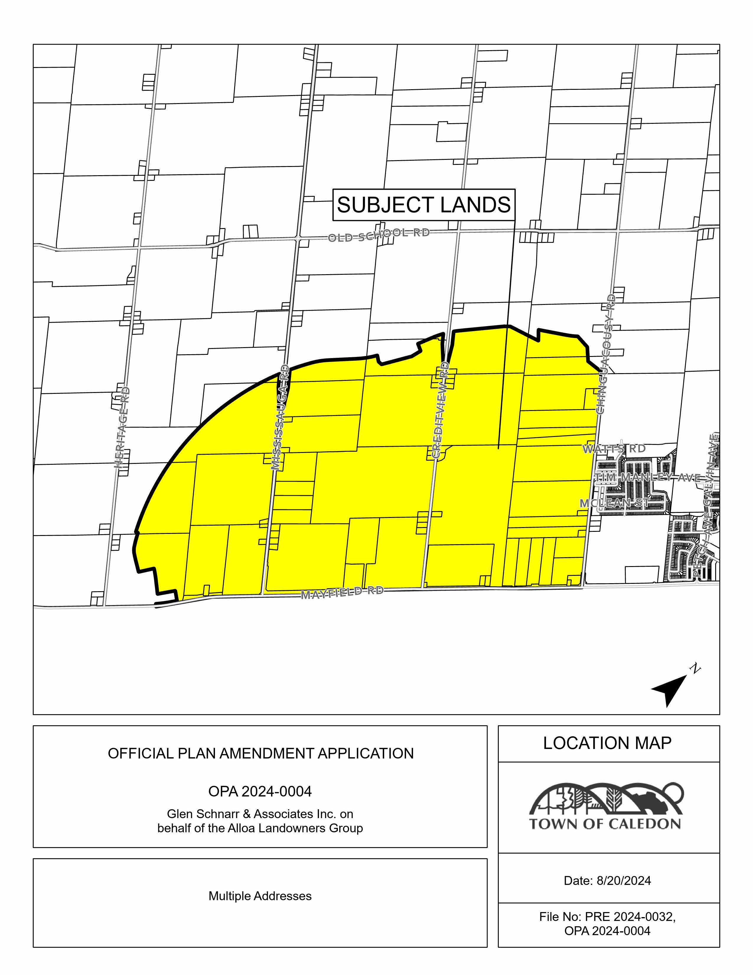
The subject lands are 725 hectares (1,800 acres) bounded by the Highway 413 Protection Corridor to the north and west, Chinguacousy Road to the east, and Mayfield Road to the south.
Project Name: Glen Schnarr & Associates on behalf of Alloa Landowners Group
Town File Number: POPA 2024-0004
| Location Map |
 |
| Official Plan Amendment |
|
The applicant is proposing to amend the Future Caledon Official Plan to establish the Alloa Secondary Plan. The proposed amendment establishes objectives and policies to govern the development of land within the Alloa Secondary Plan Area by amending Part H of the Official Plan and adding a new Section 33 for new Secondary Plans under the Future Caledon Official Plan.
The applicant is proposing to establish the Alloa Secondary Plan to redesignate the lands to permit a range of uses including residential, employment, education, recreation, parks and open space, cultural and community facilities, affordable housing, and a public road network. |
| Tertiary Plan |
| The applicant has submitted a Tertiary Plan for Phase One of the Alloa Secondary Plan. |
Updates and Notices
Lead Planner
Tanjot Bal, Senior Planner
Planning & Development
905.584.2272 x. 4448
Tanjot.bal@caledon.ca
Additional Resources
For more information about this matter, or to provide comments, feedback or ask questions, please contact the Lead Planner at 905-584-2272 ext. 4274 from Monday to Friday, 8:30 a.m. to 4:30 p.m.


 Subscribe to this page